
Coordination on one live map
Connect your people. Prevent collisions. Fill the gaps between your operational systems.
Every update — from any team, or from the community — visible to every stakeholder in their own context the moment it happens.
What others leave open
The gaps other tools leave open
At least one of these is a gap no competing tool closes.
Your network never disappears behind a number.
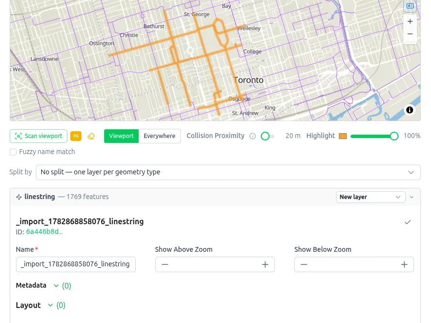
Other tools collapse a large dataset into summary dots. Aptli draws every pole, cable, and road at full fidelity, up to 25× more features than typical tools.
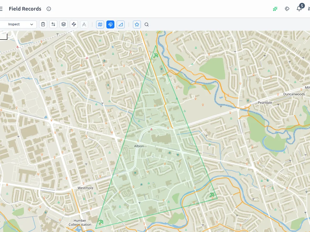
Catch the collision before the crew does.
When teams and areas overlap, work collides — silent duplicates that surface later as expensive rework. Aptli puts those clashes on the map before anyone mobilizes.
Asset counts that update themselves.
When work is marked complete, the record changes automatically. No manual reconciliation at month end. The data reflects reality the instant the job is done.
A record nobody can edit their way out of.
Independent validations, full change history, access control enforced at the server. Proof of what was done, by whom, when, and whether it passed.
For Delivery / Project Managers
Stop managing from a Gantt chart that can't tell you where the problem is.
Delivery surprises aren't random. They're geography problems disguised as scheduling problems. A Gantt shows what's scheduled, not where, and not the travel time between jobs.
- Read the health of the whole project at a glance. Jobs colorize on the map by status.
- Know what's actually happening, right now. Status updates the moment it changes in the field.
- Stop losing time to geography you couldn't see. Travel time is visible before it blows the schedule.
For Engineering
Stop chasing data errors. Start delivering clean designs.
Design data arrives from multiple sources and formats, bringing duplicates, overlaps, and conflicts that only surface later as expensive field rework.
- Your network never disappears behind a number. Every feature renders at full fidelity, in the browser.
- The conflict gets caught before the crew does. Overlaps become map markers you resolve at your desk.
- One definition, enforced. Every layer carries a formal standard tied to its content.
For the Field
Submit your work your way — a text, an email, a photo, or your voice.
The gap between finishing a job and getting paid is paperwork. Forms to fill, photos to attach, records to submit. Every error means a delay.
- Say it; don't type it. Speak your completion report and Aptli generates the work-order report.
- The photo proves the work, not just the visit. It feeds directly into the report.
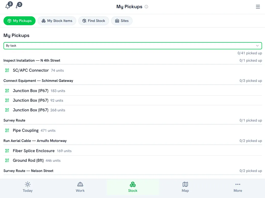
- Know what's yours to pick up before you drive there. Nearby stock, sorted by distance.
Who it's for
Built for any team coordinating work — construction, utilities, and the public sector
One platform, tuned to how your industry actually runs.
Construction
Designs graduate from proposed to built as work closes, with a full audit trail behind every record. Field execution and proof in one chain.
Utilities
Full-fidelity geographic visibility and contractor isolation across the network. Residents report outages straight from the map.
Municipal
Turn field data into council-ready budget defense, see service gaps by neighborhood in real time, and let residents report issues from their phone.
Key capabilities
Thoughtful features that shine beyond the problems it solves
Give the community a two-way channel
A public reporting channel at its own URL, no login needed. Residents snap a photo, location auto-fills, the right form appears, a ticket is created — and they're kept in the loop in real time. Community field intelligence at zero cost to your team.
Build plans and verify work with AI
Generate buildings and snap alignments instead of drawing them. Let AI turn a spoken report and a photo into a completion record, flagging any claim the picture doesn't back up.
Location-aware by default
Geography is a first-class signal: nearby stock sorted by distance, travel time between jobs visible before it costs you, and field locations captured automatically.
Qualification checks, not checkpoints
Confirm the right people hold the right tickets for the work or the materials. It's advisory only: it flags, it never blocks, and needs no rigid setup before you start. Other tools either lock you out or make you configure it all up front. This does neither.
Start anywhere, no setup tax
No project to create, no job to define, not even a work order. Just make a report, or if you're crowdsourcing, just make a submission. Maps, inventory, and reporting each work on their own, so you get value before you've configured anything.
Your brand, on your own domain
More than a logo swap. White-label the name, branding, and even what appears on permits and official documents. Then serve it from your own domain (i.e. yoursite.com/maps or yoursite.com/outages). A seamless experience that makes your data yours, not a third party's tool.

See Aptli in action.
A short walkthrough of the live map. See how it connects your people, prevents collisions, and opens a channel to the community — and get your questions answered.